

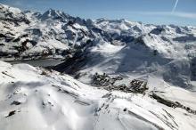
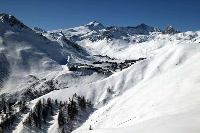
HAT Snow Report for 20 March, 2010
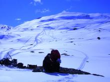
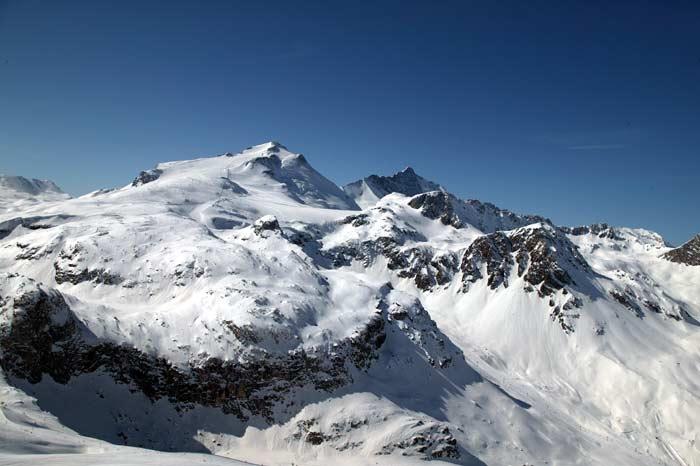
This past week has shown us more sun than any other week this season. It has remained cold above 2000 metres though, which has kept the snow in pretty condition except on South facing slopes and at lower altitudes where a bit of melt-freeze has started, but hasn’t really brought us a lot of spring skiing yet.
Looks like the spring skiing will have to wait a little while longer as cloudy weather is coming in for this weekend and will mix with some sun into mid-week this coming week. The clouds will produce light precipitation at times in the form of rain up to 1800 metres and a bit above at least through Tuesday according to the forecast.
Snow Quality and Stability
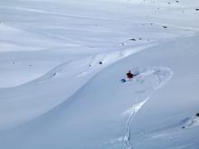
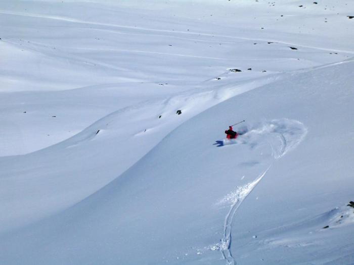
In sum, there has been some great snow out there (soft snow; soft & hard wind blown and even a bit of smooth spring) IF you were willing to look for it and walk for it. Experienced off-piste skiers have had a great time over the past week.
Snow Quality:
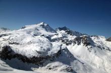
The snow on North’ish faces has been a combination of cold wind-blown snow that is pretty hard/smooth/chalky (some breakable crust here and there); ‘pisted off-piste’ from skier traffic where there’s easy access from lifts; and, away from high off piste skier traffic, powder and/or ‘de-consolidating’ snow that is ‘loosening up’ into an agreeable granular type soft snow (the powder and loosening granular old snow is due to the cold temperatures especially at night over the last two weeks).
Some of the melt-freeze on South facing slopes has brought a nice smooth spring snow ‘transformé’ on lower altitudes (below 2400 m) mainly on steep slopes, but most South’ish facing slopes have developed a nasty breakable crust that will need a good amount of new snow on top in order not to feel it under-foot.
Snow Stability:
The cold powder and loosening up of the snowpack due to cold temps on the North’ish facing slopes has accentuated the potential for high instability once we get new snow – there continued to be quite a few accidental avalanches over the past two weeks on steep North facing slopes in the Northern French Alps even as the avalanche rating went down to 2. The snowpack is surprisingly hollow in a lot of places on North slope aspects! South’ish facing slopes have been very stable after a cold night, but have become very unstable in places once the sun has warmed them up.
With the predicted warming and rain above 1800 metres, these slopes could become very unstable during warming phases and especially rain events.
Note:
One of the biggest risks these past two weeks has been falling and sliding down hard, smooth and steep slopes. A number of very bad falls and injuries were reported last week – this may pick up again especially if we don’t get much snow this week.
Tips for this coming week
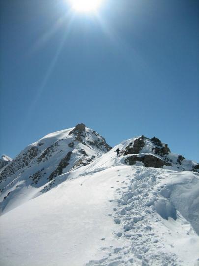
If and when it snows, I’ll be heading high and North, but I’ll be thinking about the weak layers that are still persisting up there (and you should too!) especially if and when I head out onto any steep North facing slopes.
Keep up-to-date on the snow conditions and stability by visiting our blog on www.getoffpiste.com and go to the avalanche forecast translation in the left column, OR if you can read French, on: www.meteo-france.com >Montagne>Bulletins Avalanches.
Snow Report
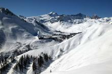
The snow is changing, you will need to walk to find untracked snow and go North and High to find softer powder.
Avalanche Bulletin from Meteo France
N73100311 - AVALANCHE BULLETIN for the SAVOIE valid outside of marked trails and open.
FOR THURSDAY, 11 MARS 2010
(written Wednesday, March 10)
RISK ASSESSMENT UNTIL THURSDAY EVENING:
Haute Maurienne: CONSIDERABLE_RISK - Level 3 Maurienne Vanoise, Haute Tarentaise Beaufortain Bauges: MODERATE_RISK - Level 2.
WEATHER OUTLOOK UNTIL THURSDAY EVENING:
In early night, cloudy excesses of Piedmont Maurienne">Haute Maurienne flakes with the latest on the border and mitigation; Bauges side, sea of clouds night and morning, also some clear night and morning, then becoming cloudy across most post afternoon with few flakes. In very high_elevations, wind is becoming lower at night, North East and North low day.
Isotherm 0 Ã'° C: plain. Isotherm -10 Ã'° C: varies between 2400 and 2700 m. Wind General to 3000 m: Is the night 20/40 and 10 km / h, Northeast and Northwest in day 10 and 20/30 km / h.
SNOW CONDITIONS:
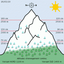
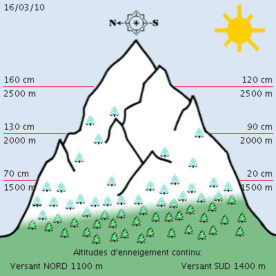
The snow began between 1000 and 1600 meters depending on exposure and slope. It is timely: in Bauges">Bauges and Beaufortain: 25-60 cm at 1200 m, 100 m to 1500 cm, 150-180 cm 1800/2000 m. Moreover, at 1500 m: 60-70 cm, 1800/2000 m: 60 to 150 cm, 3000 m: 210 cm. These values are often below average from early March except HauteMaurienne.
On the surface, the snow is often crusted or freeze by the more or less hardened by the wind, or, in Haute Maurienne is covered with some snow more or less windy.
STABILITY OF THE SNOWPACK:
SURFACE slab ESPECIALLY NEAR THE PIEDMONT. In Haute Maurienne past 48 hours, it often fell below 5 cm of snow except 10 to 25 cm along the Piedmont (25 cm to Bonneval-sur-Arc or a little more [+] closer to the border) . The winds of South-East with high Lombarde_o is formed and some accumulations of slab surface more or less hard. They rely on other small slab formed recently by the same types of wind or the Bise North to Northwest, and their adherence remains uncertain.
The passage of one skier may be sufficient to cause the rupture of these slabs, and sometimes several stacked slab or successive times in an avalanche above average above 2000 m. Taking advantage of the sunlight can also produce some attrition: surface flows or avalanches, snow or recent plate more or less brittle.
On other ranges, very little snow has fallen recently. But the wind Southeast with Foehn also blew strong yesterday and other days earlier, alternating with the Bise North to Northwest. Transportation of snow was observed every time, especially heights Bauges to senior internal and near the border and also in temporary stations. The risk remains, therefore accidental. The passage of a single skier can sometimes cause the rupture of a small shallow plate or several small slab overlapping or successive, the volume of snow mobilized remaining generally low. This risk is somewhat greater above 2200/2500 m.
However, in all ranges, cracks are always present in the snowpack, directions and various altitudes, and the risk of rupture (natural or passage of skiers and snowshoers) a bottom plate remains. In the steep north-west to north-east, a natural starting fairly large remains possible mainly above 2500 m.
EVOLUTION OF THE AVALANCHE RISK:
Little change for Friday.. (Thierry Arnou)
Weather Forecast for Northern French Alps
Situation and Prospects
Thursday, March 18:
Another mild weather with beautiful visibilities resumption of wind South-West elevation. Degradation come from the west at night.
Pressure 1032 -> 1029 mb plain: 2 / 14 ° C. Wind South / 6 knots in the afternoon to 1500m above ground: 1 / 4 ° C, wind knots SSW/10 to 3000m above ground: -3 ° C, wind WSW/12-> 22 knots iso 0 °: 2500 iso -10: 4400/4700m
Friday, March 19:
Transition day with high clouds, dense late night deviating largely midday then reforming the evening low altitude.
Pressure 1029 -> 1025 mb plain: 5 / 14 ° C, low wind to 1500m above ground: 2 -> 5 ° C, wind SSW/11-> low-> 8 knots to 3000m above ground: -4 -> -1 ° C, wind Ouest/15-> 11 -> (night) SW/14 knots iso 0 °: 2700 iso -10: 4300 -> 5000m
Weekend
Saturday gray and mild with south wind but sunny afternoon. Sinister degeneration rainy Sunday replenishing the snow to above 2300 meters.
Off Piste & Avalanche Awareness Talks: Week of 21st March:
Monday (on bad weather days) 15.30 sharp Basic Talk at the Moris in Val d’Isère Weds 18.00 sharp Basic Talk at the Pacific Bar in Val d’Isère You need to show up at least15 mins before the talk to take advantage of the deals on food & drink!
Tickets are €7.50 (one person under 18 per adult free) and includes great deals on food and drinks at each place! Pre-booking on line price is: £6 on www.henrysavalanchetalk.com (if you can’t come to a talk see our on-line talks on the web site)
HAT is taking the Talks on-snow this year for people who want to learn more in Val d’Isère & Tignes!
See www.henrysavalanchetalk.com for more info on these practical short courses.

